Using Radio Mobile for Windows
Creating a Map
Previous: Creating A Map Next: Systems And Networks
Now that you have Radio Mobile configured to use your elevation data you can begin creating maps. Click on File | Map Properties and you will again be presented with the Map Properties window. This time make sure you uncheck "ignore missing files" and have SRTM set as one of your data sources. The reason for doing this is to get Radio Mobile to tell you which SRTM data files are missing so you download the missing pieces. There are some holes in the SRTM coverage so there is a chance you will not be able to download the missing files. If this is the case check "ignore missing files" after you have filled in as many missing pieces as possible.
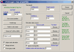
Figure 13: Map Properties Window
After you have specified the map center you may want to change the pixel size of the resulting image as well as the length and width in kilometers. Once you have completed this click on the Apply button. In a few seconds a new map will be drawn.
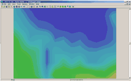
Figure 14: Sample GTOPO30 Map
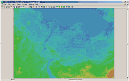
Figure 15: Sample SRTM Map
The next screenshot illustrates what happens when you disregard the notice from the GTOPO30 download page in regards to using WinZip to extract the data files.
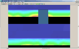
Figure 16: Bad GTOPO30
If you get output like this don't panic. Go back to the GTOPO30 download page and (re)read the notice then extract the data files again and recreate the map. If you use 7-Zip you will not have this problem.
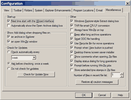
Figure 17: Disable TAR smart CR/LF conversion
To prevent the problem above from happening with WinZip, uncheck the "Disable TAR file smart CR/LF conversion" option.
If you have everything set up correctly you should be able to create maps such as those in the above screenshots. Obviously, you would need data files for northern Michigan to output the same maps.
You can also merge other pictures with your Radio Mobile maps. Select the "Merge pictures..." option from the "Edit" menu.
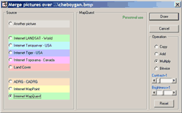
Figure 18: Merge Pictures
The next three screenshots are examples of the output of the various merge operations.
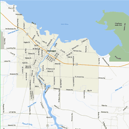
Figure 19: Mapquest Add
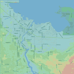
Figure 20: Mapquest Copy
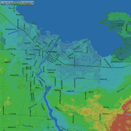
Figure 21: Mapquest Multiply
Creating maps is only one strong point of Radio Mobile. Using these maps to predict the reliability and coverage of various RF systems is the main function of Radio Mobile. The next section Systems and Networks discusses adding and modifying RF systems to Radio Mobile for use in creating RF Plots.